Why does one European town have a border that zigzags through houses and cafes
In this town, you can cross an international border just by walking to a different table in a cafe, thanks to a centuries-old territorial dispute that split homes and businesses right down the middle.

Too Long; Didn't Read
TLDR: The town of Baarle is split between Belgium and the Netherlands due to a series of confusing medieval land swaps between feudal lords. The resulting border zigzags through buildings, and a property's country is determined by which side its front door is on.
The World's Most Complicated Border: Why does one European town have a border that zigzags through houses and cafes?
Imagine sitting down for coffee, only to find your table is in the Netherlands while the counter you ordered from is in Belgium. Or picture a house where the front door determines your nationality. This isn't a scene from a quirky film; it's daily life in a unique European town. This bizarre geographical puzzle exists in one place, a town split between two nations with a border so intricate it carves through buildings, gardens, and streets. This blog post will unravel the fascinating history behind this cartographical curiosity and explore what life is like when an international border is your next-door—and sometimes, in-door—neighbor.
A Town Divided: Welcome to Baarle-Nassau and Baarle-Hertog
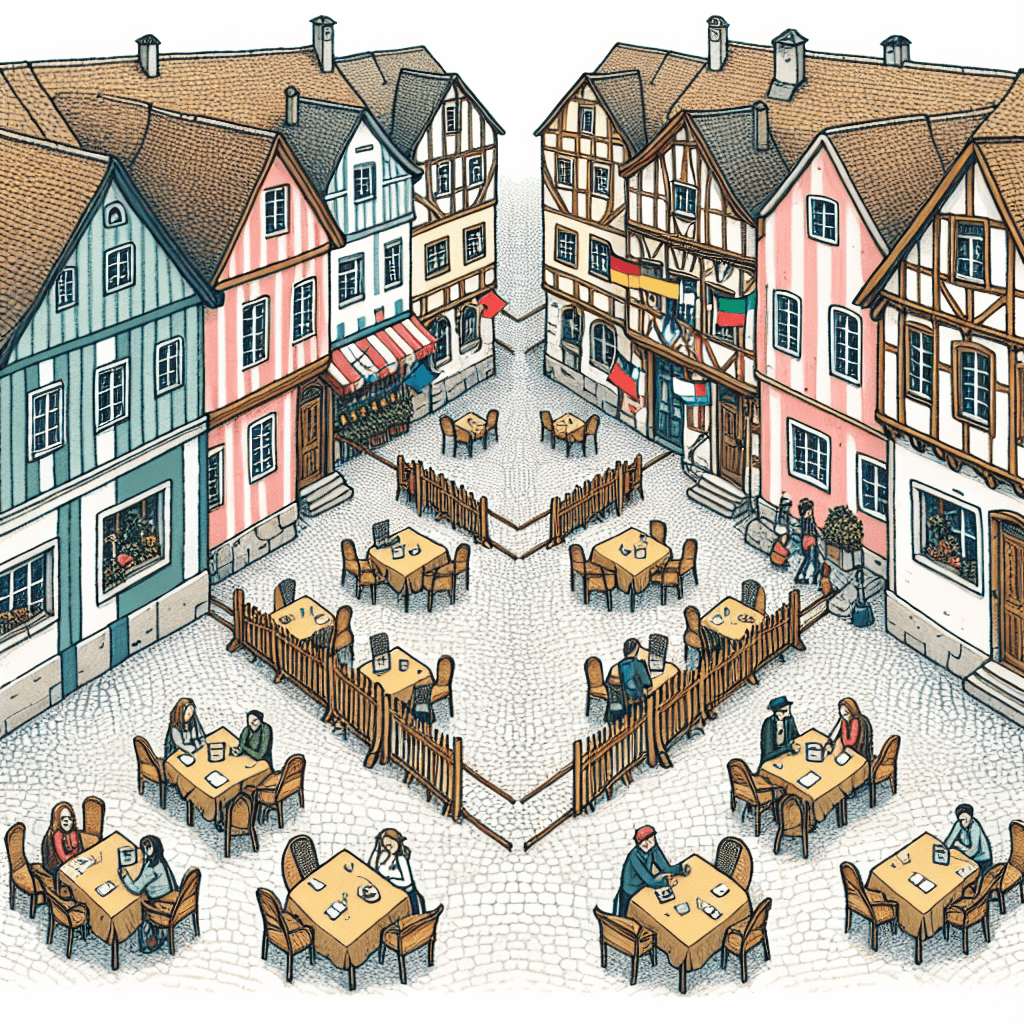
The town in question is actually two municipalities sharing the same space: Baarle-Nassau, which belongs to the Netherlands, and Baarle-Hertog, which is part of Belgium. What makes this setup extraordinary is that it isn't a simple line dividing the town. Instead, Baarle is a complex patchwork of enclaves and exclaves.
An exclave is a piece of a country's territory that is physically separated from its mainland and surrounded by the territory of another country. Baarle-Hertog consists of 22 separate Belgian exclaves entirely within the Netherlands. To make things even more confusing, within these Belgian exclaves are seven Dutch counter-exclaves belonging to Baarle-Nassau. The border, marked by white crosses and studs on the pavement, zigzags unpredictably, creating a geopolitical map unlike any other in the world.
How Did This Happen? A Medieval Land Swap Gone Wild
The roots of this complicated border stretch back over 800 years to the feudal system of medieval Europe. The story begins in 1198 with a land deal between two powerful figures: Henry I, the Duke of Brabant, and Godfried of Schoten, the Lord of Breda.
In their agreement, the Duke of Brabant kept certain parcels of land for himself (which eventually became Belgian Baarle-Hertog) while ceding the remaining territory to the Lord of Breda (which became Dutch Baarle-Nassau). The division wasn't based on a neat geographical line but on the agricultural quality and use of the land at the time. The Duke kept the most fertile, cultivated plots, leaving the less desirable or undeveloped lands to the Lord. This created a scattered, patchwork ownership map. For centuries, these complex property lines remained a local feudal arrangement. It wasn't until the Treaty of Maastricht in 1843, when the border between the newly independent Belgium and the Netherlands was formally defined, that these ancient land parcels were elevated to the status of a national border, freezing the medieval puzzle in place forever.
Daily Life on the Borderline
Living in Baarle means navigating a web of two national systems simultaneously. The nationality of a building is determined by the "voordeurregel," or the "front door rule." Whichever country a building's front door is in dictates its official address and the laws that apply to it. This has led to some remarkable situations:
- Dual-Nationality Buildings: Some homes and businesses are split by the border. One art gallery famously has a Dutch and a Belgian doorbell. A local supermarket has the border running through its aisles, forcing it to comply with food labeling laws from both countries.
- Two of Everything: The town is served by two governments, with two town halls, two police forces, two fire departments, and two postal services. A letter mailed from one side of the street to the other could be an international delivery.
- Navigating Different Laws: Residents and business owners must be experts in two sets of national laws. This was starkly highlighted during the COVID-19 pandemic. When Dutch cafes had to close under lockdown rules, Belgian cafes just across the border line—sometimes on the same terrace—were allowed to remain open, and vice-versa.
A Symbol of Cooperation
While the border's complexity could be a recipe for chaos, the reality in Baarle is one of remarkable cooperation. The two municipalities work closely together, sharing infrastructure like electricity and water and jointly managing public services. The convoluted border has become a major tourist attraction, drawing visitors from around the world who are eager to have one foot in Belgium and the other in the Netherlands at the same time.
The story of Baarle is more than just a geographical oddity; it's a living museum of European history. It serves as a powerful testament to how ancient agreements can shape the modern world in the most unexpected ways and proves that even the most complicated borders can be lines of peaceful coexistence rather than division.